Monday, March 4, 2013

The Last Hurrah


For the past few weeks,  we have been traveling through a very dry and hot climate, skirting the edges of several desert areas.  Our final leg to the end of the trip in Windhoek had us travelling to and through portions of the oldest desert in the world -- the Namib.  

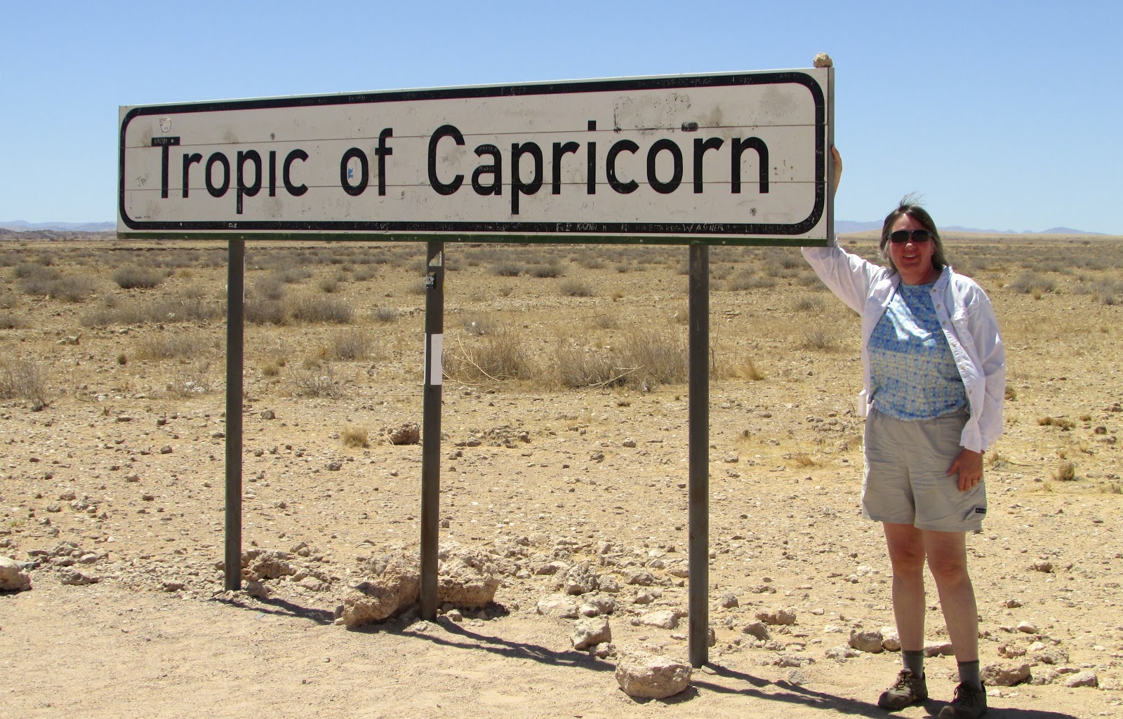
From Walvis Bay, its a long dry sand road across the dunes towards the small settlement of Solitaire.  Solitaire is the only place to get gas or anything else in that part of the country, and supposedly has an amazing bakery which was closed when we stopped.  The temperature was already over 100 degrees as we continued south towards Sesriem, the gateway to the Namib Desert.   And there, in the middle of nowhere, we crossed the Tropic of Capricorn.


Arriving at Sesriem mid afternoon, we checked in at the ranger's office and started the drive towards Sossuslevi, a 70 km drive from the campground.  We had been advised that the best time to view the dunes was at dawn or dusk to capture the sun's low angle light so we hoped to time it to see it late afternoon.

Sesriem Gate


While I didn't have a thermometer handy, we guessed the heat at this point was closer to 110 degrees.  At the end of the paved road, we stopped in a shady rest area to have lunch before tackling the sand road to the dunes.  This being Africa, there really wasn't a designated track through the sand so we followed previous travelers.  And quickly became stuck -- up to the frame.


We had been equipped with a shovel so I started digging out the wheels and frame.  Several attempts to move proved futile so I kept digging.  I lowered the air pressure in the tires which often works but still no luck.  Just then, a Toyota pickup arrives driven by a very nice French couple.  Using hand signals and broken English, we managed to rig a tow rope and Oswald came free.

We only had to travel a bit more to find an area where we could park and take a short hike on the dunes.  In addition to being the oldest desert in the world, the Namib contains what is arguably the tallest sand dune in the world.


It was still hot and I was pretty spent from shoveling but we did manage to hike a good way up it.  On the way back to camp, the sun was dropping quickly and the light created amazing shadows on the dunes.


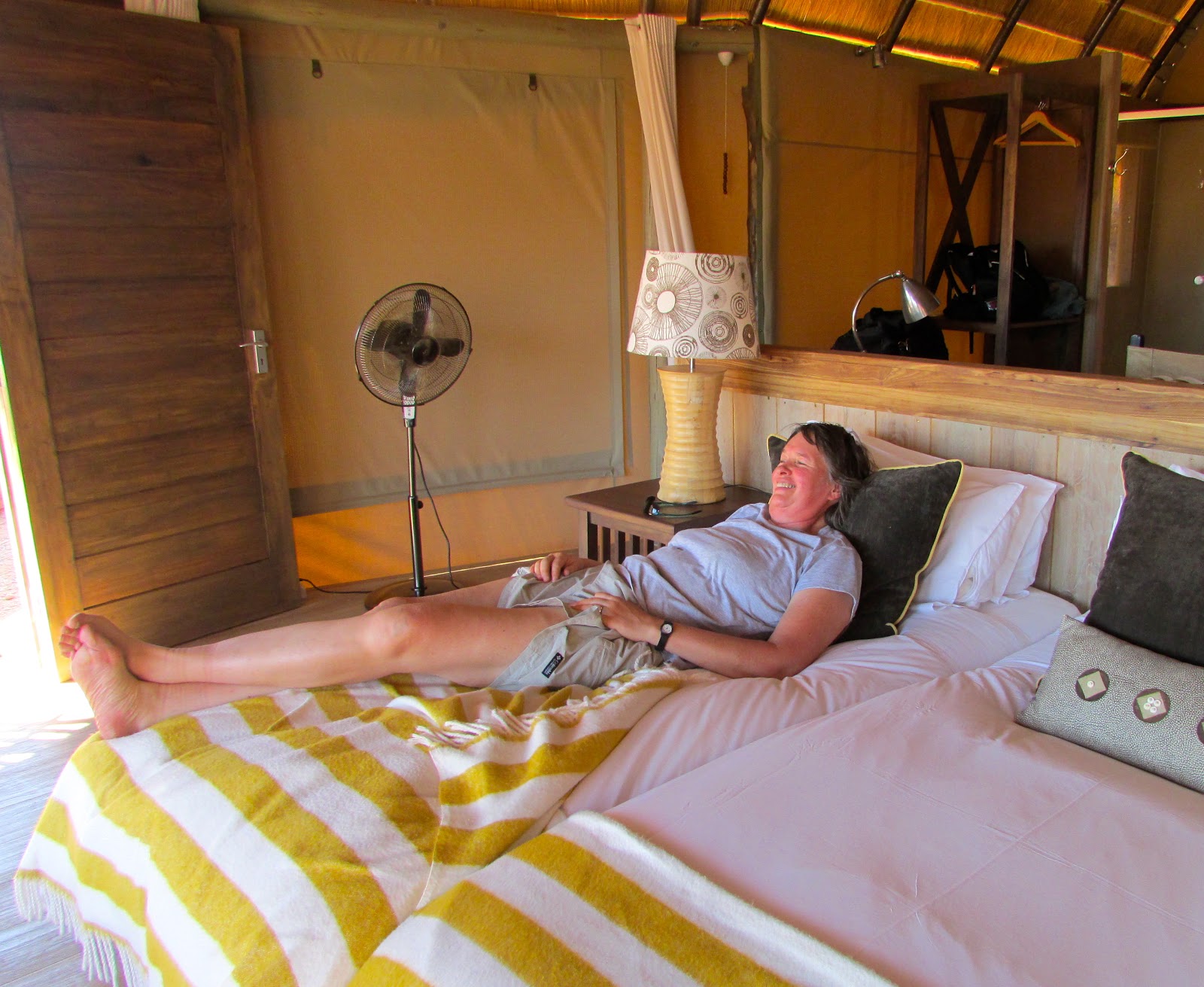
The campground was fairly busy and noisy but we cooked a nice dinner and turned in early.  The light at sunrise was spectacular.


From Sesriem, we started the drive back to Windhoek, Namibia's capital and the end of our trip.  We spent one night in a nice secluded camp near Rehoboth which afforded us the opportunity to wash clothes and pack our gear for the journey home.  A pack of baboons in the hills above entertained us until we fell asleep.

Arriving in Windhoek after driving incredibly remote country for three weeks was a bit of a let down.  All the traffic and people created quite a case of sensory overload.  After cleaning up, we headed to Joe's Beer House, a place that had been recommended by just about anyone who knew we were headed to Windhoek.  It's a pretty interesting place and in addition to a great beer selection, they apparently serve a LOT of Jagermeister.

The Mini was used by some Europeans in an unsuccessful attempt to drive the length of Africa.


We drove almost 2400 miles in just over three weeks through some of the most beautiful country anywhere.  We got stuck once, almost hit a Zebra, saw many animals and met some wonderful people.  It is often said that Africa gets under your skin and it certainly has mine.  Future trips back are currently being dreamed about, and hopefully my daughter and her family will join us.


Thanks for following along.  If anyone wants more pictures or information about places we've stayed and sights we've seen, you know where to find us.


Saturday, March 2, 2013

Sea and Sand

Spitzkoppe

The beauty of doing a self-drive vacation is you can pretty much go anywhere you want.  Our itinerary had us camping inland but we really wanted to see part of the Skeleton Coast so we zigged when we were supposed to zag.  The Skeleton Coast encompasses most of Namibia's western border and is so named because of the numerous ship wrecks that have occurred there.  A good portion of the northern part is off limits without a permit so we decided to see what we could see without one.  Eventually, the entire coast of Namibia will be considered a National Park and it will be the only country in the world that can make that claim.

En route to the coast, we detoured to see one of the most famous rock paintings in Africa, the White Lady in Brandberg.  First discovered in 1918, the figure actually depicts a male warrior and was initially believed to depict travellers visiting from the Mediterranean area.  It is now believed that local bushmen painted it about 2000 years ago.


The "White Lady"


The human legs on the back of oryx are symbols of shamanism.

Once we hit the coast at Henties Bay, we headed north to see the seal colony at Cape Cross.  Given the thousands of seals in the colony, you actually smell and hear them way before you see them.


The pups are born in December and January.


Apparently, they fear nothing.


They have no natural predators so the colonies are enormous.


This is a popular area for surf fishing so there are many roads to the beach.


The cold Atlantic.

It was getting late so we drove down to Henties Bay and found a very nice old hotel on the beach for the night.

We headed east the next morning to visit Spitzkoppe, a massive granite dome that rises from the desert that is called Namibia's Matterhorn.  A number of movies have been shot here including The Gods Must Be Crazy and 10,000 BC for which animals were imported that still live in the area.  


The approach to Spitzkoppe.


The area reminded me of Utah.

The area is famous for the thousands of rock art drawings located in the rocks.  We hired a guide who led us around to see a few of the great ones.


This depicts a shaman wearing a headdress confronting a serpent.


We headed back west towards the coast to spend two nights in Swakopmund, a beach resort with a distinctively German feel.   Oswald really needed a bath so we found a car wash run by a lovely South African woman who filled us in on all the must see places.  For the equivalent of about $12 US, the crew literally hand washed the undercarriage, removing pounds of Zambian mud and Namibian sand. 


If we didn't have return tickets, this would be an interesting journey.

Our booked overnights were at The Stiltz, a resort right on the beach where all the building are built on stilts, connected by a boardwalk.  They put us in an incredible two story villa.


Even the shower was cool.

The manager made dinner reservation at a great restaurant on the pier where we enjoyed an amazing seafood dinner.


The next day, we opted to take a boat ride out into Walvis Bay to see the oyster beds and the seal colony.  Given the abundance of seals in the area, the tour companies aren't afraid to involve the seals in the experience.  They just jump into the boat and in exchange for a few fish are more than happy to pose.


Until next time . . .

Tuesday, February 19, 2013

Desert Bound


Leaving Etosha after three days, we headed south west towards the coast.  Between us and the sea were vast expanses of desert and interesting places to visit.  We really hated leaving the park but were looking forward to seeing some of the isolated country that Namibia contains.  In square miles, Namibia is only marginally larger than the State of Texas but has a population of just over 2 million compared with Texas's 26 million.  It contains three deserts - Coastal, Kalahari and Namib - and much of it's coastline is protected in a national park.


She was waiving good by as we passed out of the park.


As we exited the park, it felt strange to be on a paved road and seeing other vehicles.  It was still very hot and we learned later that the temperature that day hit almost 45 degrees Celsius (113 F).  En route to our next overnight, we stopped to tour an amazing Petrified Forest site.  There were petrified rocks everywhere and this one tree was more than 30 meters long (almost 100 feet).


Our home for the next two nights was to be Mowani Mountain Camp which turned out to be one of the most beautiful places we have ever stayed.  The camp was built around the boulders of the region and so well integrated into the landscape you really didn't see it until you were literally on top of it.  


 The lounge and restaurant.


Our "tent".  The walls are fabric and the roof thatched.


Incredible landscape.


Linda obviously enjoying it.


To celebrate Linda's retirement, we had a candlelit dinner at a table set by that big rock.


A separate bar on a massive rock facing west. The perfect place for sun downers.

Over drinks with the manager, I made a strong case that he needed someone like me to manage that bar and live there permanently.  He said he'd get back to me -- I'm still waiting to hear.

We had a rest day so we signed up for an early morning game drive.  Since it was the low season, it was just us and Frederich, the guide, informed us he had heard about elephant sightings, so off we went.  We passed through several villages and drove up a dry river bed until we started seeing elephant tracks.


And there they were.


This young guy was very curious about the vehicle.


It was a pretty large herd and included a few young ones. They seemed oblivious to our presence as they ate from the trees.  They were moving up the riverbed and we followed along for quite awhile.

The next day, we headed out to see the rock art at Twyfelfontein, a UNESCO Heritage Site that contains one of the largest collections of rock art in Africa.  The area has been inhabited by Bushmen for thousands of years and the rock art, most of which dates back 2000 - 2500 years, was intended to show where animals and water was located.  There are close to 2500 different rock drawings in the area so we only saw a fraction of them.


This is actually a map.  The indentations in the circle signify water holes.


Note the drawing of the seal.  We are still a good distance from the coast but the Bushmen ranged over a large area.


An ostrich. Note the various positions of the neck and head.


Since we were "in the neighborhood", we decided to drive to the Doros Meteor Crater.  We could see it on the map but this being Africa, there were no signs indicating where it was.  Oswald came equipped with a GPS loaded with Tracks 4 Africa which did an excellent job preventing us from getting lost.  We hit the end of the main road, engaged the low range in 4WD and off we went.  There were a lot of tracks going off in various directions but the GPS kept us headed generally in the right direction.


Desolate country.


We got to where the GPS said the crater should be.  This rock was unlike any of the others in the area but we don't know if it's a meteor or not.


Signage

We went from our favorite lodge to what became our favorite campsite, Madisa.  It's remote and we were the only ones there.  Given its location, the local community has obviously worked very hard to create an oasis in some pretty tough country.  


Every campsite has wonderful shade,


great cooking and cleaning facilities,


and amazing showers, open to the sky.


Mud walls


Even a vessel sink.


The bonus was an almost full moon over camp.

Until next time . . .