Wednesday, December 14, 2011

Photo Journal -- 26

Fire in the Sky; near Butte, Montana

Monday, December 12, 2011

Saturday, December 10, 2011

Photo Journal -- 24

near New Bruanfelds, Texas

Friday, December 9, 2011

Photo Journal -- 23

Storm Break; Grand Canyon North Rim; Arizona

Thursday, December 8, 2011

Photo Journal -- 22

Autumn Road; near St. Paul, MN

Wednesday, December 7, 2011

Photo Journal -- 21

Rainbow Rim Trail; North Rim, Grand Canyon, AZ

Disclaimer: I did not take this photograph but it was taken on a trip I co-lead.

Tuesday, December 6, 2011

Photo Journal -- 20

Nature's colors; Farmers Market, Eugene Oregon

Monday, December 5, 2011

Photo Journal -- 19

Until Spring; St. Paul, MN

Sunday, December 4, 2011

Photo Journal -- 18

Winter tracks; near Stockholm, Wisconsin

Saturday, December 3, 2011

Photo Journal -- 17

Sand Road; White Sands National Monument; New Mexico

Friday, December 2, 2011

Photo Journal -- 16

Sunset; Columbia River; Washington

Thursday, December 1, 2011

Photo Journal -- 15

The road less travelled; near Hite Crossing, Utah

Wednesday, November 30, 2011

Photo Journal -- 14

Mountain Lake; Cascade Highway; Washington

Tuesday, November 29, 2011

Photo Journal -- 13

Point Imperial; Grand Canyon North Rim

Monday, November 28, 2011

Photo Journal -- 12

Anza Borrego State Park; California

Sunday, November 27, 2011

Photo Journal --11

Early spring snow; Los Padres National Forest; near Ojai, CA

Saturday, November 26, 2011

Photo Journal -- 10

Fall touring; Kaibab National Forest; North Rim, Grand Canyon

Friday, November 25, 2011

Photo Journal -- 9

San Francisco; view from Mt. Tamalpais

Thursday, November 24, 2011

Photo Journal -- 8

Lake Powell; Hite Crossing, Utah

Happy Thanksgiving to all.

Wednesday, November 23, 2011

Photo Journal -- 7

Fall in the "Daks"; Adirondack Park, New York

Tuesday, November 22, 2011

Photo Journal -- 6

Henry Mountains; Hatch, Utah

Monday, November 21, 2011

Sunday, November 20, 2011

Photo Journal -- 4

Desert Moon; Anza Borrego State Park, California

Saturday, November 19, 2011

Friday, November 18, 2011

Photo Journal 2

River of Smoke
Controlled burn; Crazy Jug Point; Grand Canyon North Rim

Thursday, November 17, 2011

Photo Journal 1

Sunset; Montana; Empire Builder

Wednesday, November 16, 2011

Photo Journal


I have had the great fortune over the past several years to travel to some amazing places. Travel is my passion, and I have amassed a large collection of photographs. Most were taken with my iPhone camera, and some have required some minor editing tweaks to more accurately capture what I remember seeing.

I have edited them down to a small set and over the next few weeks, will post them here on this blog. In most cases, I will release one a day but there may be times you'll see a few at a time. I'll try and post a link on Facebook but to avoid missing any, subscribe to the RSS feed for my blog.

Gulf of California, Baja Sur, Mexico

I hope you enjoy them.

Cheers

Kevin


Thursday, June 23, 2011

The Adventure Continues

From Hanksville, we headed west towards Capitol Reef National Park and beyond.


Tapestry Wall
Petroglyphs


Pioneer Register -- people would scratch their names and dates on the rock as they passed through


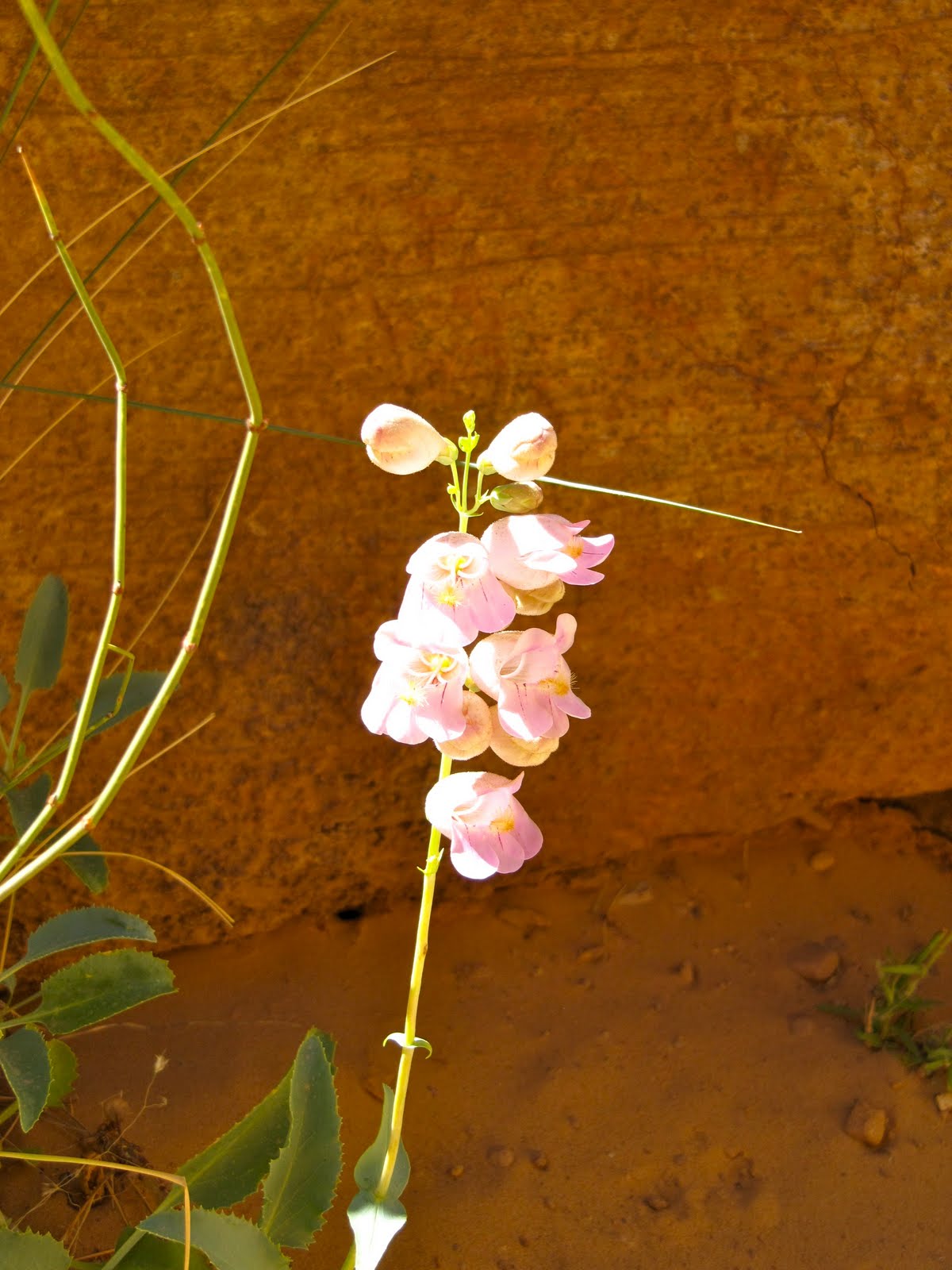
A wet spring created a great environment for desert flowers

From there, we headed south towards Boulder Town and the beginning of the Burr Trail.


Along the way, we encountered Willie pushing a beat up mountain bike and trailer up one of the grades. From Macon, Georgia, he's been on the road for 15 months. We gave him some food, and water and had a great time hearing his tales of life on the road. He works when he can get it but just seems to enjoy the solitude of traveling alone.


Waterpocket Fold; Capitol Reef

We traveled down the Notom/Bullfrog Road, eventually reaching Lake Powell at Hall's Crossing.


Crossing Lake Powell on the ferry was a great way to see the country.

After spending the night in Blanding, we headed north towards the zoo that Moab has become. Compared to the rest of the trip, Moab was packed with people and vehicles, it being the height of the tourist season. First stop was Arches National Park.


We did the hike to Delicate Arch along with a few hundred other folks.

The arch sits next to an amazing natural amphitheatre.

People kept adding to the rock cairns used as trail markers.

From Arches, we headed to the Island in The Sky District of Canyonlands National Park. Given it's about a 35 mile drive from Moab, it was far less crowded.

The La Sal Mountains still carry a heavy snow load.

A good omen, I hope.


That is the White Rim Road/Trail, a prime mountain bike route.

I convinced the missus to drive some of the Shafer Road Trail down the switchbacks a ways.


The goal was to follow the road over that hill to the overlook at Goose Neck Bend on the Colorado River.


It did not disappoint.

The cacti were in full bloom.

Heading out of Moab towards Fruita, CO, we followed the Colorado River east.

Cheers